Enceladus is one of the most compelling destinations in the solar system. Jets of water vapour and ice grains erupt from the tiger stripes at its south pole, pointing to a subsurface ocean in contact with a rocky core, and both NASA’s Decadal Survey and ESA’s Voyage 2050 report single the moon out as a priority target. Yet the spectral maps we use to connect what the surface is made of to what lies beneath remain frustratingly coarse. The Visual and Infrared Mapping Spectrometer (VIMS) aboard Cassini gathered more than eleven thousand hyperspectral cubes of Enceladus, but its ground sampling is rarely better than a few kilometres per pixel, and every observation was taken under a different illumination and viewing geometry. Super-resolution techniques developed for Mars cannot rescue this situation: they assume either many repeated passes over the same ground or enormous training sets, neither of which exists for icy moons, and the convolution filters they rely on risk inventing features that were never there.
A new study by Ntinos and colleagues takes a different route, building a complete and modular super-resolution pipeline designed from the ground up for the heterogeneous data sets that flyby missions actually produce. The pipeline has three stages. First, a new navigation module places every VIMS pixel on the surface as a polygon rather than an idealised rectangle, using a digital shape model of Enceladus so that local topography feeds into the geometry, and introduces a more conservative metric for pixel sampling that reveals the conventional calculation can underestimate the true footprint by up to a factor of twenty. Second, a global photometric correction built on the Kaasalainen-Shkuratov formalism with an Akimov disk function normalises every observation to a common viewing geometry, alongside careful handling of the instrument’s documented wavelength drift and a wavelength-dependent saturation limit derived from each cube’s own background noise. Third comes the heart of the method: Weighted Average Super-Resolution, or WASR, which lays a fine regular grid over the corrected mosaic and computes each new cell from all the original pixels overlapping it, weighted by the fraction of the pixel contained in the cell. No new spectral information is manufactured; the gain comes entirely from the sub-pixel offsets already latent in the archive.
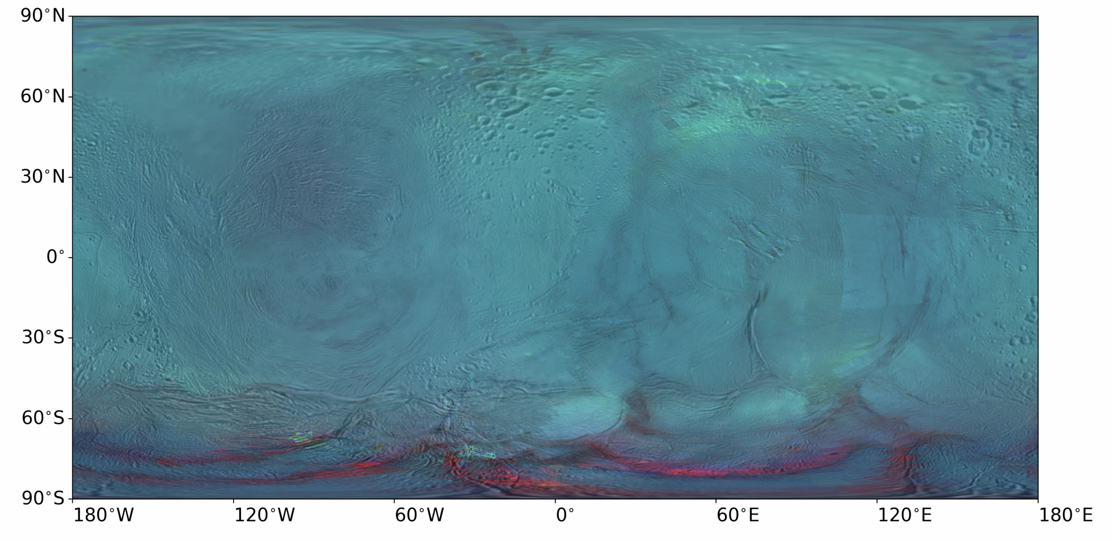
The results hold up under scrutiny. In the final global map, seams between neighbouring observations fade, large structures become continuous, and features invisible in the photometrically corrected mosaic reappear, including the northern extent of Labtyat Sulci and troughs bounding several terrain units. The authors validate this in three independent ways. Spectrally, a super-cell built from 189 overlapping pixels matches the spectrum of its best-resolved contributor almost exactly, confirming that WASR acts only in the spatial domain. Spatially, they remove a high-resolution cube from the data set, rebuild the maps without it, and show that the super-resolved map recovers small-scale features that only the withheld cube could see. Independently, feature positions line up with the high-resolution Cassini ISS mosaic.
The payoff is scientific, not just cartographic. A false-colour (RGB) composite tuned to diagnostic water-ice wavelengths shows crystalline ice concentrated along the tiger stripes and the fractured region encircling the south pole in sharper detail compared to previous efforts, consistent with fresh plume deposition, while the older cratered terrain between the leading and trailing hemispheres shows the shallower absorptions expected of processed, smaller-grained ice. The improved maps sharpen the boundary between a prominent spectral feature at 30°N, 90°W and the LH smooth geological unit, and resolve previously unseen sub-units within the central leading hemisphere terrain. Because the pipeline is modular and target-agnostic, it transfers directly to other icy moons and, crucially, to the hyperspectral data that JUICE will return from Ganymede. The same analysis that quantifies where super-resolution works best also indicates what observing geometries would maximise its effectiveness, turning a reprocessing tool into a mission-planning one. The code is openly available, and the message is broader than Enceladus: even for planetary bodies we have visited only in passing with missions that have now concluded, the archives can still produce extraordinary new insight.
Read the paper:
Super-resolution maps of icy moons: Application to the Cassini-VIMS observations of Enceladus with updated navigation and photometric correction
Christos Ntinos, Sébastien Rodriguez, Stéphane Le Mouélic, Rozenn Robidel, Benoît Seignovert, Thomas Cornet, Nicolas Altobelli, Gabriel Tobie, and Claire Vallat
Planetary Research, 1(3), 349, 2026. https://doi.org/10.53480/arz2-gn59